

Drought Mitigation Center, United States National
National Drought Mitigation Center: Faculty Publications
Accessibility Remediation
If you are unable to use this item in its current form due to accessibility barriers, you may request remediation through our remediation request form.
Document Type
Article
Date of this Version
2021
Citation
Published in Earth Systems and Environment 5 (2021), pp 561–573.
doi:10.1007/s41748-021-00245-2
Abstract
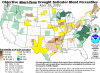
Droughts can cause devastating impacts on water and land resources and therefore monitoring these events forms an integral part of planning. The most common approach for detecting drought events and assessing their intensity is use of the Standardized Precipitation Index (SPI), which requires abundant precipitation records at good spatial distribution. This may restrict SPI usage in many regions around the world, particularly in areas with limited numbers of ground meteorological stations. Therefore, the use of remotely sensed derived data of precipitation can contribute to drought monitoring. In this study, remotely sensed precipitation estimates from the POWER/Agroclimatology archive of NASA and their derived SPI for different time intervals were evaluated against gauged observations of precipitation from 13 different stations in arid and semiarid locations in Jordan. Results showed significant correlations between remotely sensed and ground data with relatively high R values (0.67–0.91), particularly where seasonal precipitation exceeded 50 mm/year. For evaluation of remotely sensed data in SPI calculation, several objective functions were used; the results showed that SPI based on satellite estimates (SAT-SPI) showed good performance in detecting extreme droughts and indicating wet/dry conditions. However, SAT-SPI showed high tendency to overestimate drought intensity. Based on these findings, remotely sensed precipitation from the POWER/Agroclimatology archive showed good potential for use in detecting extreme meteorological drought with the provision of careful interpretation of the data. These types of studies are essential for evaluating the applicability of new drought monitoring information and tools to support decision-making at relevant scales.
Included in
Climate Commons, Environmental Indicators and Impact Assessment Commons, Environmental Monitoring Commons, Hydrology Commons, Other Earth Sciences Commons, Water Resource Management Commons
Comments
Copyright © 2021 King Abdulaziz University and Springer Nature Switzerland AG; published in partnership with CECCR at King Abdulaziz University. Used by permission.