

North American Crane Working Group
Proceedings of the North American Crane Workshop
Accessibility Remediation
If you are unable to use this item in its current form due to accessibility barriers, you may request remediation through our remediation request form.
Date of this Version
2001
Document Type
Article
Citation
Richert, Amy L. and Church, Kevin E. Multiple spatial scale analysis of whooping crane habitat in Nebraska. In: Ellis, David H., ed., Proceedings of the Eighth North American Crane Workshop, 11–14 January 2000, Albuquerque, New Mexico (Seattle, Wash: North American Crane Working Group, 2001), p. 217.
Abstract
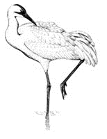
Geographic Information System (GIS) and remote sensing technologies were used to evaluate whooping crane stopover habitat in Nebraska. The goal of the research was to investigate habitat selection at multiple spatial scales. The GIS database consisted of all confirmed whooping crane sightings reported in Nebraska from 1975-1996 and land cover information delineated from color infrared aerial photographs and Landsat Thematic Mapper data. Results suggest that whooping cranes select roost habitat by recognizing site-level and landscape-scale land cover composition. Wetland is the most strongly selected habitat type at all spatial scales examined. This presentation emphasizes methods used to analyze habitat selection and how the information can be applied in conservation.
Included in
Behavior and Ethology Commons, Biodiversity Commons, Ornithology Commons, Population Biology Commons, Terrestrial and Aquatic Ecology Commons
Comments
Reproduced by permission of the North American Crane Working Group (NACWG).