

Natural Resources, School of
Conservation and Survey Division: Faculty and Staff Publications
Accessibility Remediation
If you are unable to use this item in its current form due to accessibility barriers, you may request remediation through our remediation request form.
Document Type
Article
Date of this Version
1-2020
Citation
Divine, D.P. and Howard, L.M., edited by Diffendal, Jr. R.F., 2020. Interpretive Geologic Maps and Cross Sections for Phelps, Kearney, and Adams Counties in Nebraska. Conservation & Survey Division, School of Natural Resources, University of Nebraska - Lincoln
Abstract
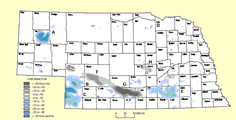
Data from thousands of test-hole and well logs were interpreted to improve understanding and management of the High Plains aquifer in a three-county study area adjacent to the Big Bend reach of the Platte River. Five principal conclusions resulted from these interpretations: (1) the extent of Neogene Ogallala deposits beneath the study area is different than previously mapped; (2) a large paleovalley incised into Cretaceous bedrock probably cuts across Kearney and Adams counties and may be the course of the ancestral Platte River prior to formation of the Big Bend; (3) a groundwater mound created by irrigation canals artificially raises the water table in Phelps County and the western half of Kearney County, but dissipates in central Kearney County; (4) groundwater nitrate concentrations appear to be higher in Quaternary sediments than in the underlying Ogallala Group; (5) a potentially widespread, but discontinuous, silt and clay unit with varying amounts of sand is located at or near the top of the aquifer. Correlation of this unit across the study area is uncertain, as is its origin, but it may be a pre-Illinoian loess. More research is necessary to better delineate the paleovalley system incised into the Cretaceous bedrock and to identify the origin, extent, and hydrologic significance of the silt and clay unit(s). Despite remaining uncertainties, the geology of the study area indicates a history of shifting drainage patterns, climate changes, and Laramide structural deformation.
Included in
Geology Commons, Geomorphology Commons, Hydrology Commons, Paleontology Commons, Sedimentology Commons, Soil Science Commons, Stratigraphy Commons
Comments
GMC-39