

Natural Resources, School of
Conservation and Survey Division: Faculty and Staff Publications
Document Type
Map
Date of this Version
1979
Citation
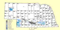
Inferred Areal Extent of the Oligocene (White River Group) Chadron Basal Sand. Map. No Scale. Nebraska High Plains-Ogallala Aquifer Study Area series. Lincoln: University of Nebraska. Print. (date unknown, 1979?)
Abstract
Inferred Areal Extent of the Oligocene (White River Group) Chadron Basal Sand. Map. No Scale. Nebraska High Plains-Ogallala Aquifer Study Area series. Lincoln: University of Nebraska. Print. (date unknown, 1979?)
Included in
Geology Commons, Geomorphology Commons, Hydrology Commons, Paleontology Commons, Sedimentology Commons, Soil Science Commons, Stratigraphy Commons
Comments
GM-52.1