United States Fish and Wildlife Service

United States Fish and Wildlife Service: Publications
Date of this Version
June 1947
Abstract
The national wildlife refuge at Chincoteague, Virginia, is one of the newest in a chain of sanctuaries placed along the flight lanes of the waterfowl. Coming down from the north the principal links of the chain are Parker River, Montezuma, Susquehanna, Brigantine, and Bombay Hook. Then from Chincoteague the links run south, through Back Bay and Pea Island, Mattamuskeet and Cape Romain. Chincoteague, like other waterfowl refuges, is needed because birds migrate, and because in so doing they expose themselves to great dangers.
The migration of birds is one of the ancient spectacles of earth, and one of the most mysterious. But while we know little about why birds migrate or how they find their way over enormous distances, common sense tells us this: like human travelers, birds must have places where they can stop in safety for food and rest.
Once there were plenty of natural hostelries for the migrants. That was before our expanding civilization had drained the marshes, polluted the waters, substituted resort towns for wilderness. That was in the days when hunters were few. In those days our waterfowl probably numbered 200 million. Now only a small remnant of this number is left.
If we are to preserve the remaining waterfowl, and the sports and recreations which depend on them, we must set apart for the birds refuges like Chincoteague, where they may find these simple and necessary creature requirements: food, rest, security.
Chincoteague was selected as a refuge site because the biologists of the Fish and Wildlife Service, after years of searching for the best spot to fill the gap between the refuges at Bombay Hook and Back Bay, decided that this wild seacoast island on the Eastern Shore of Virginia would provide protection and breeding territory for the greatest number of species. Purchase of this site for a refuge was approved by the Migratory Bird Commission in 1942; and the refuge was formally placed under administration by the Fish and Wildlife Service in 1945.
Two things determined the location of the Chincoteague Refuge: its physical features, combining beaches, dunes, marshes, woodland, and protected waters; and its position with relation to the flight lanes of the birds. As to the first: About nine thousand acres in area, the refuge occupies the southern third of Assateague Island, separated from Chincoteague Island by a narrow channel. Assateague is one of the barrier islands typical of the Middle Atlantic coast, never more than three miles from shore to shore, lying between Chincoteague Bay and the sea. Seen from the air, as the migrating waterfowl coming in from the north must see it, its eastern border is a wide ribbon of sand that curves around in a long arc at the southern end of the island to form a nearly enclosed harbor. Back from the beach the sand mounts into low dunes, and the hills of sand are little by little bound and restrained by the beach grasses and the low, succulent, sand-loving dune plants. As the vegetation increases, the dunes fall away into salt marshes, bordering the bay. Like islands standing out of the low marsh areas are the patches of firmer, higher ground, forested .with pine and oak and carpeted with thickets of myrtle, bayberry, sumac, rose, and catbriar. Scattered through the marshes are ponds and potholes filled with wigeongrass and bordered with bulrushes and other good food for ducks and geese. This is waterfowl country. This is the kind of country the ducks knew in the old days, before the white man's civilization disturbed the face of the land. This is the kind of country that is rapidly disappearing except where it is preserved in wildlife sanctuaries.
The pattern of the flyways, more than any other fact, determines the location of the waterfowl refuges. A flyway is more than a migration route-it is a whole geographic region. There are four such flyways in the United States: the Atlantic, the Mississippi, the Central, and the Pacific. Although the breeding grounds of the various flyways overlap, each has its own wintering grounds, and a complex system of migration paths leading from winter to summer areas.
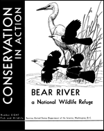
23 pages, with illustrations by Shirley A. Briggs and Katherine L. Howe


Comments
Conservation in Action series, no. 1
UNITED STATES GOVERNMENT PRINTING OFFICE, WASHINGTON : 1947