

Antarctic Drilling Program (ANDRILL)
ANDRILL Research and Publications
Accessibility Remediation
If you are unable to use this item in its current form due to accessibility barriers, you may request remediation through our remediation request form.
Document Type
Article
Date of this Version
2007
Abstract
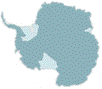
The aim of the McMurdo Ice Shelf (MIS) Project was to obtain a continuous sediment core through approximately ~1 200 metres (m) of Neogene (~0-10 Ma) glacimarine, terrigenous, volcanic, and biogenic sediment that has accumulated in the Windless Bight region of the McMurdo Ice Shelf (Fig. 1). The present-day MIS forms the northwest part of Ross Ice Shelf where it has been pinned by Ross Island for the last ~10 k.y., and is nourished by ice sourced from East Antarctic Ice Sheet (EAIS) outlet glaciers in the southern Transantarctic Mountains (TAM). The drill site was situated above a flexural moat basin adjacent to Ross Island that formed in response to Quaternary volcanic loading of the crust by Ross Island, superimposed on more regional subsidence associated with Neogene extension of the Terror Rift (Horgan et al. 2005; Naish et al. 2006; Fig. 2).
Between 29 October and 26 December 2006 a single 1 285 m-deep, drill core (AND-1B) was recovered from the bathymetric and depocentral axis of the moat in 943 m of water from an ice- shelf platform. The drilling technology employed a sea-riser system in a similar fashion to the Cape Roberts Project (CRP), as well as a combination of soft sediment coring (in upper soft sediments) and continuous wireline diamond-bit coring. Innovative new technology, in the form of a hot-water drill and over-reamer, was used to make an access hole through 85 m of ice and to keep the riser free during drilling operations.
The MIS Project has two key scientific objectives:
• Provide new knowledge on the Late Neogene behaviour and variability of the Ross Ice Shelf/Ice Sheet (RIS) and the West Antarctic Ice Sheet (WAIS), and their influence on global climate, sea level, and ocean circulation.
• Provide new knowledge on the Neogene tectonic evolution of the West Antarctic Rift System (WAR), Transantarctic Mountains (TAM), and associated volcanism.
A key outcome of the project will be to provide age control for, and determine the environmental significance of, seismic reflectors that have been mapped regionally within the Victoria Land Basin (VLB) (Henrys et al. this volume; Fielding et al. in press; Wilson et al. in press) in order to assess the regional impact of global climatic and local tectonic events. A second key outcome of the project will be to use palaeoclimatic proxies and boundary conditions to help constrain numerical global climate and dynamical ice sheet models. The specific climatic, environmental, and tectonic aims and objectives of the MIS Project are outlined in the Scientific Logistics Implementation Plan for the ANDRILL McMurdo Ice Shelf Project (SLIP; Naish et al. 2006).
This volume presents the initial science results of the AND-1B drill-hole and drill core, and associated short soft-sediment cores recovered as part of the MIS Project. The first iteration of this volume was compiled on ice as part of the Web-based MIS Project On-Ice Report. It has subsequently been expanded to include the results of continuing multidisciplinary core-characterisation activities conducted off–ice, prior to a core workshop held at Florida State University, Antarctic Marine Geology Research Facility, 1-4 May 2006. In this section we provide contextual background on the geological and environmental setting, site surveys, and stratigraphic prognosis prior to drilling. This is followed in Falconer et al. (this volume) by an operational overview of the environmental conditions that affected drilling, the drilling operation itself, the curation and management of the core and the science operations both at the drill site and at Crary Laboratory. The rest of the volume provides the initial scientific characterisation of the drill core set out under major discipline areas. Finally, we offer some initial syntheses and areas of further investigation.
Comments
Published in Terra Antartica, 2007, 14(3), 121-130. © Terra Antartica Publication 2007