

Natural Resources, School of
Conservation and Survey Division: Faculty and Staff Publications
Accessibility Remediation
If you are unable to use this item in its current form due to accessibility barriers, you may request remediation through our remediation request form.
Document Type
Article
Date of this Version
1981
Citation
Sounders, Vernon L. 1981Geology and Groundwater Supplies of Southern Dawes and Northern Sheridan Counties, Nebraska. Lincoln: Conservation & Survey Division, UNL. pp. 142.
Abstract
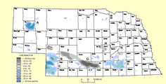
The upland plain in southern Dawes and northern Sheridan counties of northwest Nebraska is underlain by rocks of Tertiary age. These rocks overlie those of Cretaceous and Jurassic ages in this region of about 2250 square miles . Strata of Tertiary age are a source of groundwater for most of the irrigation, municipal, stock, and rural-domestic needs of the area.
Nine stratigraphic units of Tertiary.age were defined by examination of test hole samples and logs and by examining electric logs of oil and gas tests, driller's logs of irrigation wells, and outcrops. Stratigraphic correlations are difficult in the area because the stratigraphy and structural geology is complex . An unnamed section of brown, sandy siltstones overlying the Whitney Member of the Brule Formation is given the informal name, Beaver Wall siltstone beds.
Rocks of the Ogallala Group are the most permeable rocks in the area. More than 300 irrigation wells and wells of two municipalities tapped water supplies in these rocks by the end of 1979. At that time, approximately 100 irrigation we11s and wells of another two municipalities obtained groundwater supplies from the Arikaree Group, which is comprised of the Gering Formation, Monroe Creek-Harrison formations, and the Upper Harrison beds. The Arikaree Group is estimated to contain more water than the Ogallala Group, but the fine grain size of the Arikaree presents difficulties for efficiently utilizing this water.
Included in
Geology Commons, Geomorphology Commons, Hydrology Commons, Paleontology Commons, Sedimentology Commons, Soil Science Commons, Stratigraphy Commons
Comments
OFR-29