

Natural Resources, School of
Conservation and Survey Division: Faculty and Staff Publications
Accessibility Remediation
If you are unable to use this item in its current form due to accessibility barriers, you may request remediation through our remediation request form.
Document Type
Article
Date of this Version
2-2020
Citation
Kuntz, T. Sibray, S. Reedy, J., Yill, J., Hallum, D., 2020, A.R., Mapping the Base of the High Plains Aquifer using Borehole Geophysical Logs and Airborne Electromagnetic Surveys in Western Nebraska . University of Nebraska-Lincoln, Conservation and Survey Division, Open File Report 210, 21 pp.
Abstract
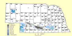
The project scanned and reviewed data from 15,421 oil and gas well geophysical logs in 13 counties to delineate the base of aquifer and thickness of the High Plains Aquifer (HPA). The data and interpretations from this study can be used in a regional groundwater modeling effort that includes the Western Water Use Management Modeling (WWUMM) and the and the Cooperative Hydrology Study (COHYST) model. The area studied is in the Upper Platte River Basin. The Nebraska Department of Natural Resources (NeDNR) has designated most of the area as either overappropriated or fully appropriated, where groundwater is managed jointly
by both local Natural Resources Districts and the NeDNR. Improved maps of the base of the aquifer can also help the Nebraska Oil and Gas Conservation Commission (NOGCC) in establishing minimum surface casing depths to protect groundwater when oil and gas wells are being drilled. Data from the scanned logs can also be used by the general public to explore for groundwater where the HPA is thin or absent and another aquifer may be present.
Included in
Geology Commons, Geomorphology Commons, Hydrology Commons, Paleontology Commons, Sedimentology Commons, Soil Science Commons, Stratigraphy Commons
Comments
OFR-210