

Natural Resources, School of
Conservation and Survey Division: Faculty and Staff Publications
Accessibility Remediation
If you are unable to use this item in its current form due to accessibility barriers, you may request remediation through our remediation request form.
Document Type
Article
Date of this Version
1971
Citation
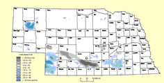
1971. Shaded Topographic Map Of Nebraska. Scale: 1:250,000. Conservation & Survey Division
Included in
Geology Commons, Geomorphology Commons, Hydrology Commons, Paleontology Commons, Sedimentology Commons, Soil Science Commons, Stratigraphy Commons
Comments
Photographically reduced from the 1:250,000 U.S. Geological Survey topographic maps of Nebraska.