

Drought Mitigation Center, United States National
National Drought Mitigation Center: Faculty Publications
Accessibility Remediation
If you are unable to use this item in its current form due to accessibility barriers, you may request remediation through our remediation request form.
Document Type
Article
Date of this Version
3-23-2021
Citation
Benedict, T.D.; Brown, J.F.; Boyte, S.P.; Howard, D.M.; Fuchs, B.A.; Wardlow, B.D.; Tadesse, T.; Evenson, K.A. Exploring VIIRS Continuity with MODIS in an Expedited Capability for Monitoring Drought-Related Vegetation Conditions. Remote Sens. 2021, 13, 1210. http://doi.org/10.3390/ rs13061210
Abstract
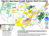
Vegetation has been effectively monitored using remote sensing time-series vegetation index (VI) data for several decades. Drought monitoring has been a common application with algorithms tuned to capturing anomalous temporal and spatial vegetation patterns. Drought stress models, such as the Vegetation Drought Response Index (VegDRI), often use VIs like the Normalized Difference Vegetation Index (NDVI). The EROS expedited Moderate Resolution Imaging Spectrora-diometer (eMODIS)-based, 7-day NDVI composites are integral to the VegDRI. As MODIS satellite platforms (Terra and Aqua) approach mission end, the Visible Infrared Imaging Radiometer Suite (VIIRS) presents an alternate NDVI source, with daily collection, similar band passes, and moderate spatial resolution. This study provides a statistical comparison between EROS expedited VIIRS (eVIIRS) 375-m and eMODIS 250-m and tests the suitability of replacing MODIS NDVI with VIIRS NDVI for drought monitoring and vegetation anomaly detection. For continuity with MODIS NDVI, we calculated a geometric mean regression adjustment algorithm using 375-m resolution for an eMODIS-like NDVI (eVIIRS’) eVIIRS’ = 0.9887 × eVIIRS − 0.0398. The resulting statistical comparisons (eVIIRS’ vs. eMODIS NDVI) showed correlations consistently greater than 0.84 throughout the three years studied. The eVIIRS’ VegDRI results characterized similar drought patterns and hotspots to the eMODIS-based VegDRI, with near zero bias.
Included in
Climate Commons, Environmental Indicators and Impact Assessment Commons, Environmental Monitoring Commons, Hydrology Commons, Other Earth Sciences Commons, Water Resource Management Commons
Comments
CC-BY