

Drought Mitigation Center, United States National
National Drought Mitigation Center: Faculty Publications
Accessibility Remediation
If you are unable to use this item in its current form due to accessibility barriers, you may request remediation through our remediation request form.
Document Type
Article
Date of this Version
2005
Citation
ISPRS Journal of Photogrammetry & Remote Sensing 59 (2005) 244– 253
doi:10.1016/j.isprsjprs.2005.02.003
Abstract
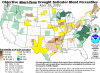
Droughts are normal climate episodes, yet they are among the most expensive natural disasters in the world. Knowledge about the timing, severity, and pattern of droughts on the landscape can be incorporated into effective planning and decisionmaking. In this study, we present a data mining approach to modeling vegetation stress due to drought and mapping its spatial extent during the growing season. Rule-based regression tree models were generated that identify relationships between satellite-derived vegetation conditions, climatic drought indices, and biophysical data, including land-cover type, available soil water capacity, percent of irrigated farm land, and ecological type. The data mining method builds numerical rule-based models that find relationships among the input variables. Because the models can be applied iteratively with input data from previous time periods, the method enables to provide predictions of vegetation conditions farther into the growing season based on earlier conditions. Visualizing the model outputs as mapped information (called VegPredict) provides a means to evaluate the model. We present prototype maps for the 2002 drought year for Nebraska and South Dakota and discuss potential uses for these maps.
Included in
Climate Commons, Environmental Indicators and Impact Assessment Commons, Environmental Monitoring Commons, Hydrology Commons, Other Earth Sciences Commons, Water Resource Management Commons
Comments
U.S. government work