

United States National Drought Mitigation Center
National Drought Mitigation Center: Faculty Publications
Document Type
Article
Date of this Version
2008
Citation
GIScience & Remote Sensing, 2008, 45, No. 1, p. 16–46.
DOI: 10.2747/1548-1603.45.1.16
Abstract
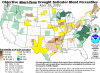
The development of new tools that provide timely, detailed-spatial-resolution drought information is essential for improving drought preparedness and response. This paper presents a new method for monitoring drought-induced vegetation stress called the Vegetation Drought Response Index (VegDRI). VegDRI integrates traditional climate-based drought indicators and satellite-derived vegetation index metrics with other biophysical information to produce a 1 km map of drought conditions that can be produced in near-real time. The initial VegDRI map results for a 2002 case study conducted across seven states in the north-central United States illustrates the utility of VegDRI for improved large-area drought monitoring.
Included in
Climate Commons, Environmental Indicators and Impact Assessment Commons, Environmental Monitoring Commons, Hydrology Commons, Other Earth Sciences Commons, Water Resource Management Commons
Comments
U.S. government work