

United States Fish and Wildlife Service
United States Fish and Wildlife Service: Publications
Date of this Version
June 1950
Abstract
In the autumn of 1824 a buffalo-hide canoe drifted down the Bear River to its mouth in the Great Salt Lake of Utah. Within sight of that vast inland sea, Jim Bridger must have paused in amazement. Everywhere he looked-in the sky, on the open water, over the marshy borders of the lake-there were birds. It is said that the famous explorer of the western wilderness brought back reports that he had that day seen "millions of ducks and geese."
The Bear River marshes were soon to know years when their waterfowl were numbered, not by millions, but by thousands; when the white settlers had diverted water for irrigation and drained the wet lands where the waterfowl found food and protection; when gunners had slaughtered them by the thousands; and many others had fallen prey to diseases resulting from this disastrous series of events.
But now a miracle of conservation has been accomplished, and once again, as in the days of Jim Bridger, the skies over Bear River are patterned with millions of wings. The Bear River Migratory Bird Refuge which helped accomplish this miracle is one of the show places of the continent. About 20,000 people visit it annually. Here, especially during the fall migration, it is literally possible to see a million ducks in one day. Here many species considered rare elsewhere may be seen by anyone who will drive his car slowly around the miles of gravel road that crown the retaining dikes of the marshes. Here are birds that, in their north and south flights, have touched almost all parts of the western half of the continent. The site of this great spectacle is a key spot in the conservation of North American birds.
The Bear River marshes were not always as they are today. The setting of the refuge has been molded, first by the slow processes of nature, then more rapidly through changes resulting from human settlement of the region. Some of the latter changes have been for the better, some for the worse.
High up on the flanks of the mountains around the flat marshlands of the refuge there are plainly marked terraces that stand out as light streaks against the blue background of the mountains. These were the shorelines of ancient Lake Bonneville, a large inland sea that covered some 20,000 square miles of this part of the world during the Pleistocene Epoch, same scores of thousands of years ago. Rain and snow fell heavily during those times, and streams ran full with the water of melting ice during the interglacial periods. Lake Bonneville was 1,000 feet deep in places. Through Red Rock Pass in its northern rim its waters drained by way of old channels of the Snake and Columbia Rivers into the Pacific Ocean.
Over the centuries the climate underwent a change from wet to dry, and with increasing aridity the level of the lake fell below its outlet and drainage ceased. The area covered by water shrank; the lake became increasingly salty. Great Salt Lake is the present-day remnant of old Lake Bonneville; it is a tenth the size of its ancestral lake, its average depth is not more than 20 feet, and it contains one part of salt to five parts of water. The flat land enclosed within the rim of mountains is the former floor of Lake Bonneville. This is the site of the Bear River Refuge.
Illustrations by Bob Hines
Comments
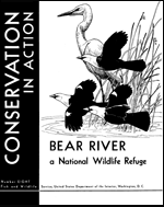
Conservation in Action series, no. 8
UNITED STATES GOVERNMENT PRINTING OFFICE, WASHINGTON : 1950